Solving for Slope Stability
AI Powered Rock Mass Characterization for Slope Stability
Accurate geological insights are critical for understanding the slope stability of your site. Traditionally, geologists or geotechnical engineers have had to be involved in order to accurately predict safe slope geometries. Without them slopes are designed according to median values or averages for key design parameters.
Using average values to calculate slope requirements results in average odds. 50-50 is not a good bet.
In many cases you may be following guidelines that are more conservative than is necessary for your site, decreasing opportunities for expansion and site maximization. In other cases, the averages will not be enough to adequately safe guard your site putting you at risk for slope failures that could injure people, damage equipment, or interfere with operations.
Design Challenges for Slope Stability
Stable slope design is dramatically improved by the early identification of significant strike changes of lithological units that may negatively interact with the desired slope geometry. By identifying early on geological characteristics that could cause instabilities, site planners can better account for the difficult geologies in their design and know in advance which sections to keep an eye on if needed.
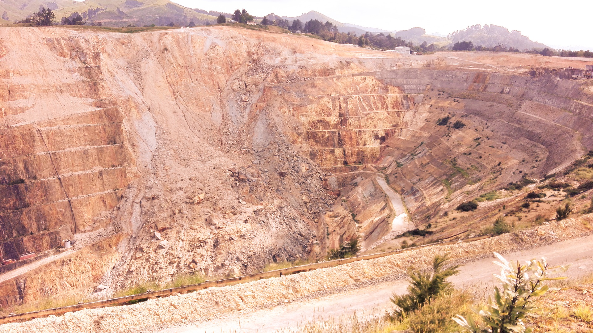
In areas with complex geological environments slope design can be particularly challenging. One way to address this is to use data from dip analysis and rock mass modelling. However, routinely applied geotechnical data is usually sparse or focused only on a narrow volume around vertical, 2D design cross sections, which are oriented perpendicular to slope strike.
A better way, is to use drone and 3D modelling technology to create 3D models of sites that can be updated as frequently as the site's geometry changes.
Slope Design- a Risk-Based Approach
Immediate economic maximization of the site is often in direct competition with risk mitigation. However, considering the potential repercussions of a slope failure, the cost-benefit analysis is much more of a gamble then a simple cost-benefit equation. A balance must be struck between the mineral resource estimate and the slope design. Therefore, steepening slope angles to their safe limits is the goal.
The best risk-benefit balance for a company requires quantifying the risk level by
- Defining acceptable risk in terms of safety and economics
- Benchmarking against industry norms and the corporate mission statement
- Assessing relative risk levels for different slope configurations
Predictability Decreases Risk
In order to reach the goal of optimal and safe extraction of the mineral reserve, mining needs to be progressively more predictable (Vorster, 2001).
To increase predictability in mining, more data and better systems are needed to identify risks, classify them, and plan for them. Geologies must be quickly and easily identified. Software that can manage the data regarding the geologies and derive insights therefrom must be implemented and used. The insights derived from the software must be acted upon. And the entire cycle must be repeated, verified, and refined.
Rock Mass AI for Identifying and Analyzing Geology
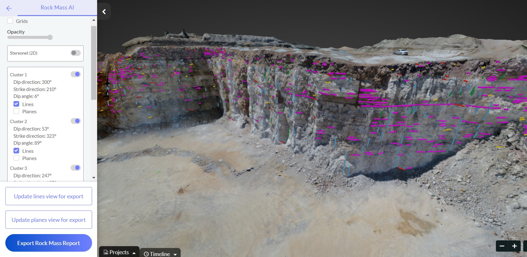
Using Computer Vision and Artificial Intelligence it is now possible to quickly and easily identify geological characteristics using images gathered by drones.
AI capabilities include automatically detecting bedding planes, seams, joints, spaces and fractures from the bench face. The data on the discontinuities can be viewed using spherical projections or mapped directly onto the 3D model of the bench or site generated from the drone images. The AI can calculate the dip angle and dip direction allowing for further integration into operations planning and design for site construction, slope monitoring, or drill and blast planning.
Rock Mass AI for Slope Stability Predictions
For those mines and quarries fortunate enough to be able to invest in geotechnical experts and geotechnical block modeling to assist with their designs, incorporating Rock Mass AI that easily identifies, tracks, and models geological features from bench faces is the obvious next step.
The AI can be applied to map and identify planes, dips, and discontinuities after each blast and every time new faces are revealed. The model simply needs to updated or verified after each change. A drone can map an entire bench face in minutes and shortly after uploading the images the AI will detect and identify the planes and discontinuities it finds on the face. These 3D models, added onto the existing block modeling and site planning models, will confirm suspected geologies or discover new ones. Each blast gives new insights into the geology of the sight.
For those mines and quarries that choose not to invest in geotechnical block modeling or geotechnical engineers, Rock Mass AI can yield significant benefits.
Knowing the bedding planes, discontinuities, dip plane and direction merely from the face of a bench allows for an unprecedented ability to identify potential risky geologies and slopes as they are revealed. By creating a new model with every flight, a site's geology can be pieced together giving confidence in the nature of the site and predictions for other slopes and their stabilities. This geology can be modelled "forward" into the surrounding earth, making predictions about what is geology likely to be encountered as the site is continuously expanded. This foreknowledge of upcoming geology makes it easier to plan for slope stability in advance of blasting or excavating.
Slope Monitoring with Rock Mass AI
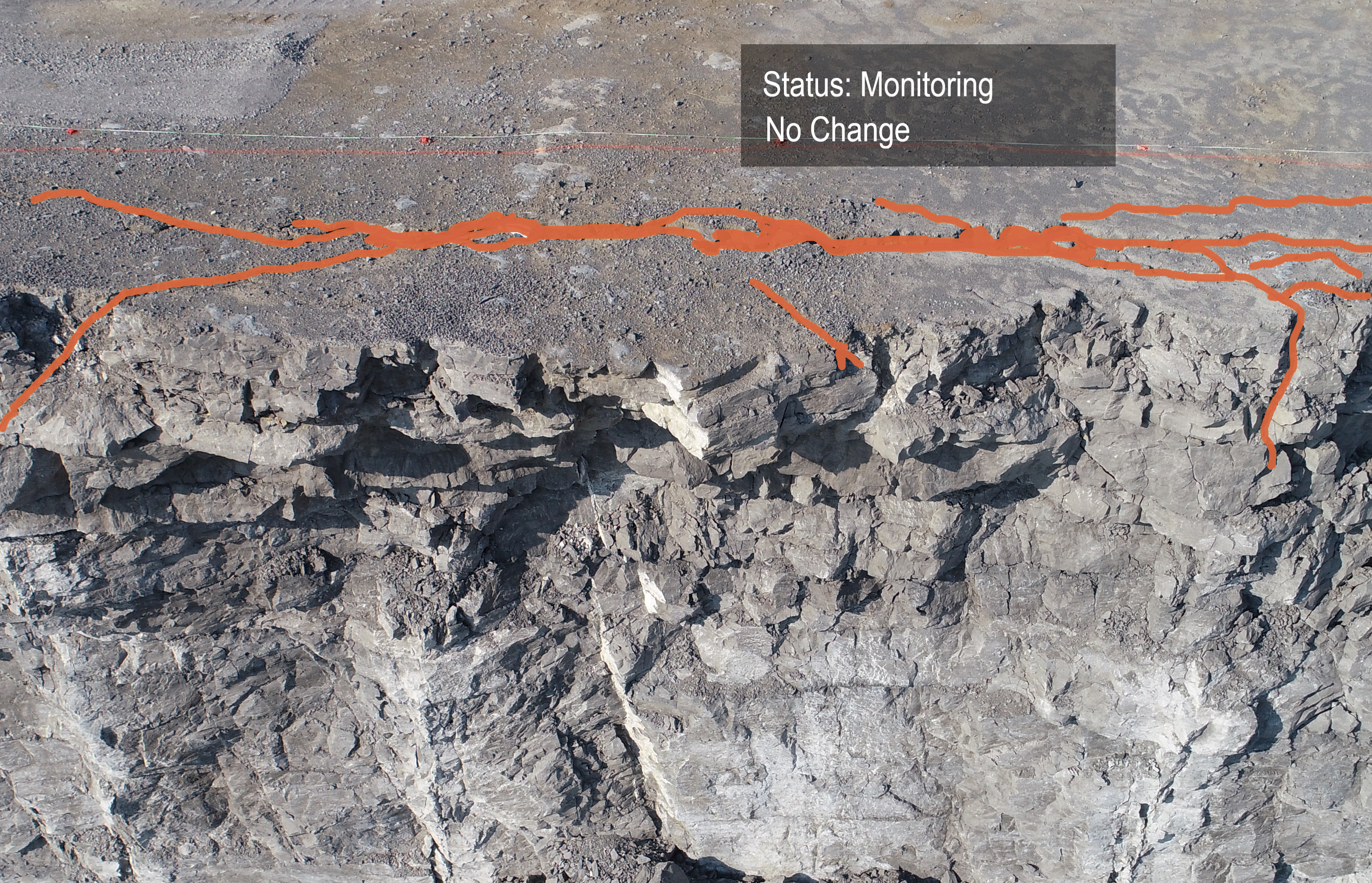
Rock Mass AI's detection of discontinuities isn't limited to merely detecting bedding planes and dip directions. It can also be used to identify cracks- like those that appear before a face slips off, and deformations at the toe that signal movement in the earth above. Comparing the day to day, and if necessary more frequent, measurements creates a record of the slopes that can be used to predict failures not only in the existing slope, but potentially in other similar geologies. The AI can track the data of the circumstances identifying not only an optimal slope to avoid failure, but also what events might lead up to and trigger a failure.
Rock Mass AI is not limited to pit slopes either, it can be used to monitor embankments, haul roads, tailings pond dams, and so much more.
With Rock Mass AI you get a wealth of insights into the geology of your site. You can plan ahead for optimum slopes and monitor risky areas- effectively maximizing profit and minimizing risks.
![]()
Check out our 2 Free E-books on AI applications for the drilling, blasting, and mining industries to see all the amazing advances that are available.
AI Guide for Drilling and Blasting
AI Guide for Mining
TLDR? Watch our videos instead:
YouTube