Death by a Thousand Ruts: How AI Exposes the True Cost of "Good Enough" Haul Roads
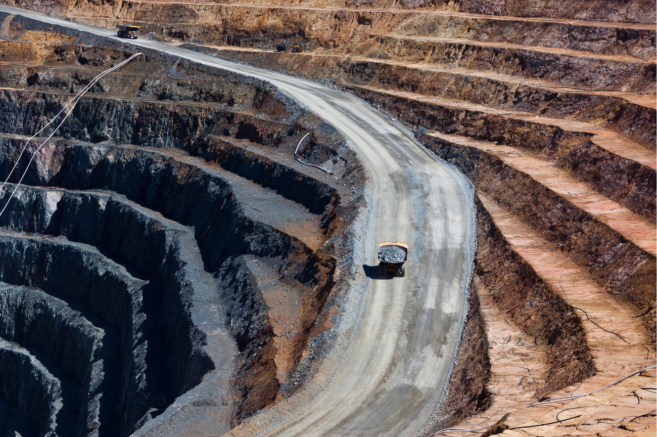
Most mines and quarries lose money every day because of the condition of their haul roads and they don’t even know it. Sometimes site management suspects an issue- but without data they can’t quantify it. And without numbers they are missing the big picture and slowly bleeding out dollars and time.
Haul roads don’t suddenly fail. They gradually lose efficiency. Early signals that are often overlooked because the road still “looks good:
- A drop in truck speed approaching tight corners
- haul trucks dropping an extra gear on the main road
- operator complaints
- truck bunching
- increasing fuel consumption
- primary crusher running empty between loads
In high-volume mining operations, even a 1% inefficiency can translate into significant daily losses.
The Hidden Cost of Inefficient Haul Roads
Haulage accounts for up to 40-60% of total mining operating costs, yet roads are often managed reactively. Degradation leads to:
- Increased Cycle Times: Truck speeds can drop 10-20%. Whether its due to having to break around tight or blind corners, managing too steep grades, or driving over poor road conditions. A sudden grade break can force a loaded Cat 777 to downshift out of torque lockup and kill momentum.
- Increased Fuel Consumption: Fuel burn can jump 5-15%. From engines straining up roads that are too steep, from idling due to bunching or waiting for other equipment to pass tight spots, or just due to poor road maintenance- rutting, washouts, etc.
💡Every 1% increase in rolling resistance (from rutting, soft spots, or spillage) acts like adding 1% of adverse ramp grade, forcing trucks out of torque converter lockup and burning extra diesel.
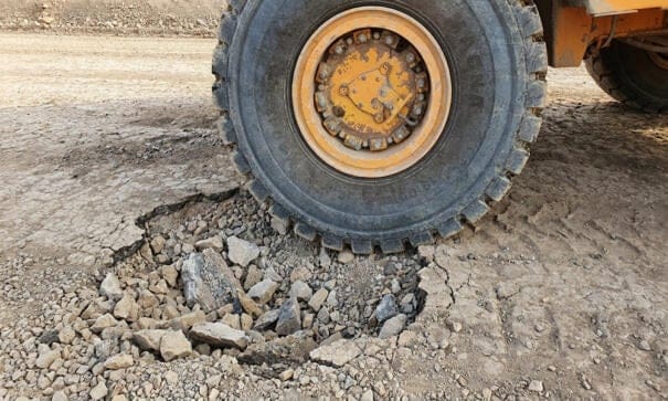
- Reduced Tire Life: Uneven surfaces, spillage, and tight corners scrub rubber and cause cuts. A single cut sidewall on an OTR haul truck tire costs $30,000 to $50,000+—not counting the hours of lost production waiting on a tire truck.
- Higher Maintenance Costs: Washboarding and potholes send shock loads and vibration through truck frames, accelerating suspension strut wear and steering component fatigue.
Why Traditional Haul Road Inspections Fall Short
Manual visual inspections are a poor way to monitor haul roads. They rely heavily on experience and judgment, not data, have limited accuracy, and are unable to quantify the effect of road issues on operations.
For Example:
- Eyeballing It: A superintendent driving a pickup can spot a massive pothole, but nobody can eyeball a 1.5% vs. 3% cross-fall or a subtle grade break from inside a cab.
- Surveyor Safety & Traffic Delays: Putting a surveyor on an active haul lane with a GPS rover puts boots in the blind spots of 100-ton trucks and disrupts cycle times.
- Default Grading: Without data, graders don’t necessary know where they are and aren’t needed. They might run a fixed route—burning fuel blading sections that don't need it (and stripping away good road crown/fines) while missing a newly formed rut or washout on a secondary bench.
In mines and quarries eyeballing it, delays caused by personnel on site and planning maintenance based on out of date or bad information directly inflates costs. Not to mention they’re time consuming, prone to human error, and create safety risks.
The Shift to Intelligent, Data-Driven Haul Road Management
Intelligent, data-driven haul road management utilizes technology to fill in the gaps. With AI and digital twins, even the most minor defects can be detected, quantified, and managed- with only a drone flight and the click of a button.
- automate detection of berms, widths, grades, crossfalls, potholes, spillage, rutting, turn radius, elevations, and more
- detect minor deviations with centimeter level accuracy
- analyze an entire site in seconds- just toggle on the feature you want to see, then turn it off again
- have customizable tolerance thresholds based on site needs
- accept a variety of design files to compare reality to
- can connect data from different parts of the mining operations to connect the dots- like blast performance, fleet management software, engine performance, empty crusher time, etc
You Already Have the Data, No Additional Hardware Needed, No Extra Work
Modernizing haul road management does not require bolting accelerometers onto haul trucks or adding extra field crews. Most quarries and mines already fly a drone regularly, whether its for site inspections, stockpile inventories, or blast designs.
By applying photogrammetry and AI-driven terrain analysis to those existing drone flights, team members can generate a high-resolution digital twin of the entire haul network—turning routine aerial imagery into measurable road intelligence without interrupting haul cycles.
Shifting from subjective visual checks to quantitative road data changes the daily maintenance conversation from "Where does the road look rough?" to three actionable questions:
- Where exactly is cycle time being lost?
- Which specific road segments pose an immediate safety or tire hazard?
- How severe is each defect relative to our site standards?
This empowers proactive, precise maintenance—identifying critical areas instantly, prioritizing by severity, correcting defects early, and continuously evaluating road conditions, geometry, and safety. No delays. No extra work.
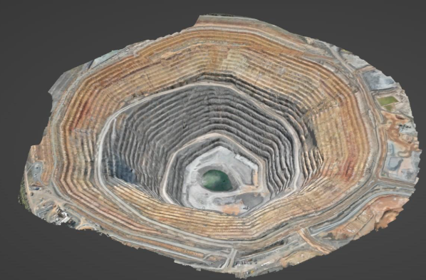
What Data-Driven Haul Road Intelligence Measures
Combining drone-captured data and digital twins with AI-powered solutions, sites can expect consistent, measurable, and repeatable insights across the entire haul road network. AI solutions don’t just identify haul road issues. They quantify them and empower teams to act with precision.
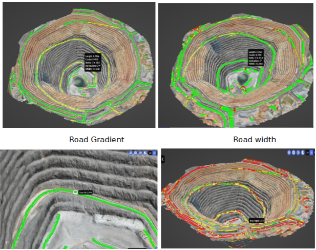
Road Geometry & Design
- Gradient and Grade Breaks: Pinpointing over-steep ramp sections and abrupt grade transitions that force downshifts and spike fuel burn.
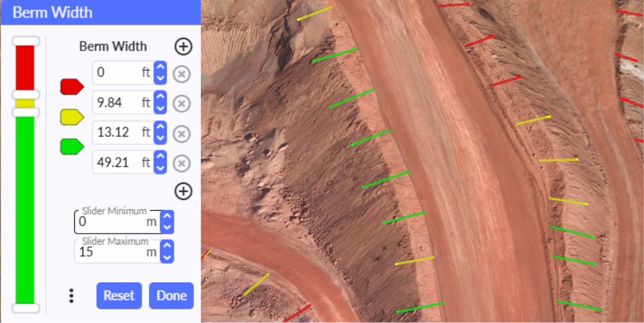
- Running Width: Automatically flag pinch points where road width narrows below safe two-way passing clearances (typically 3x to 3.5x truck width).
- Cross-fall evaluation: Catch flat or negatively banked sections before rainwater pools, turns surface fines into slurry, and destroys the sub-base.
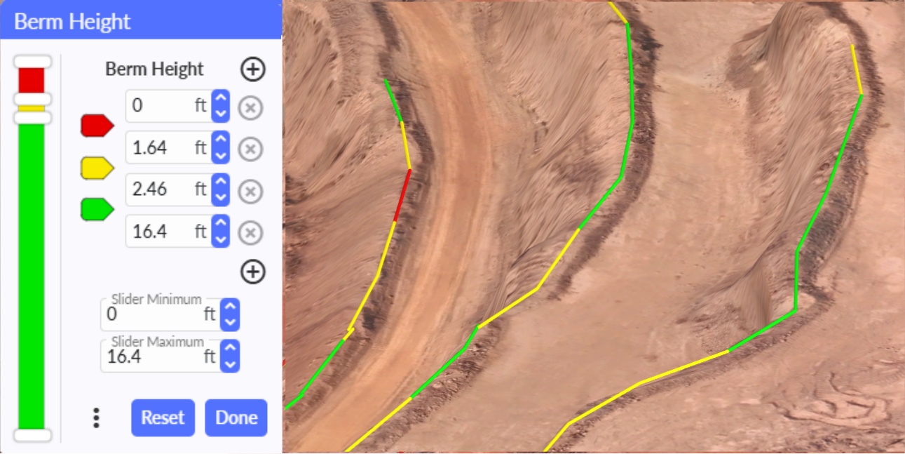
- Berm height checks: Automatically flag every linear foot where safety berms fall below MSHA mid-axle height requirements (30 CFR § 56.9300) for your largest haul truck—giving you documented proof before an inspector arrives.
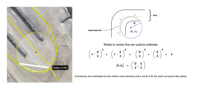
- Turn Radius optimization: Identify tight switchbacks that scrub expensive OTR tires and create operator blind spots.
Surface Condition Monitoring
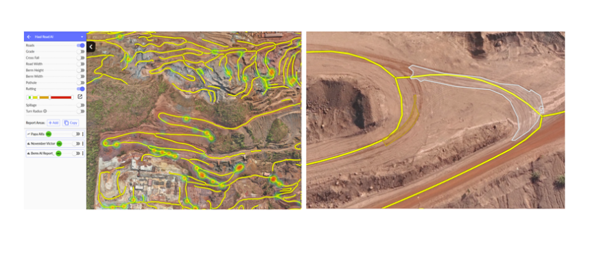
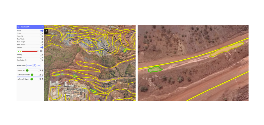
- Potholes & Rutting: Quantify wheel-path deformation and surface depressions that drive up rolling resistance and hammer truck suspensions.
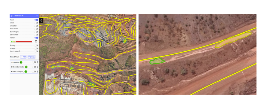
- Spillage detection: Pinpoint rock spilled from overloaded beds or poor blast fragmentation before a haul truck slices a $40k sidewall
From Data to Action
Unlike conventional methods of haul road monitoring and management, AI solutions doesn’t just highlight problems- they deliver actionable insights that you can immediately put to work:
- Audit Against Site-Specific Thresholds: Rather than sifting through raw elevation data, teams set their exact fleet rules (such as a 10% maximum ramp grade, 4-foot minimum berm height, or maximum allowable rut depth) to automatically isolate only the segments that violate site standards.
- Pinpoint exact locations of defects: Export a color-coded map, PDF report, or CSV coordinates so your grader operator goes straight to the problem instead of guessing or wasting time. Or if larger fixes are necessary, know exactly where and what to minimize disruption and re-work expense.
- Flight-by-Flight Change Monitoring: Compare next week's drone flight side-by-side against last week's to see if new defects appeared, minor ones become critical, or verify the grader crew actually restored the road crown or rebuilt the berm ensuring accountability.
Ensure the right problem is fixed at the right time.
The End of the Road
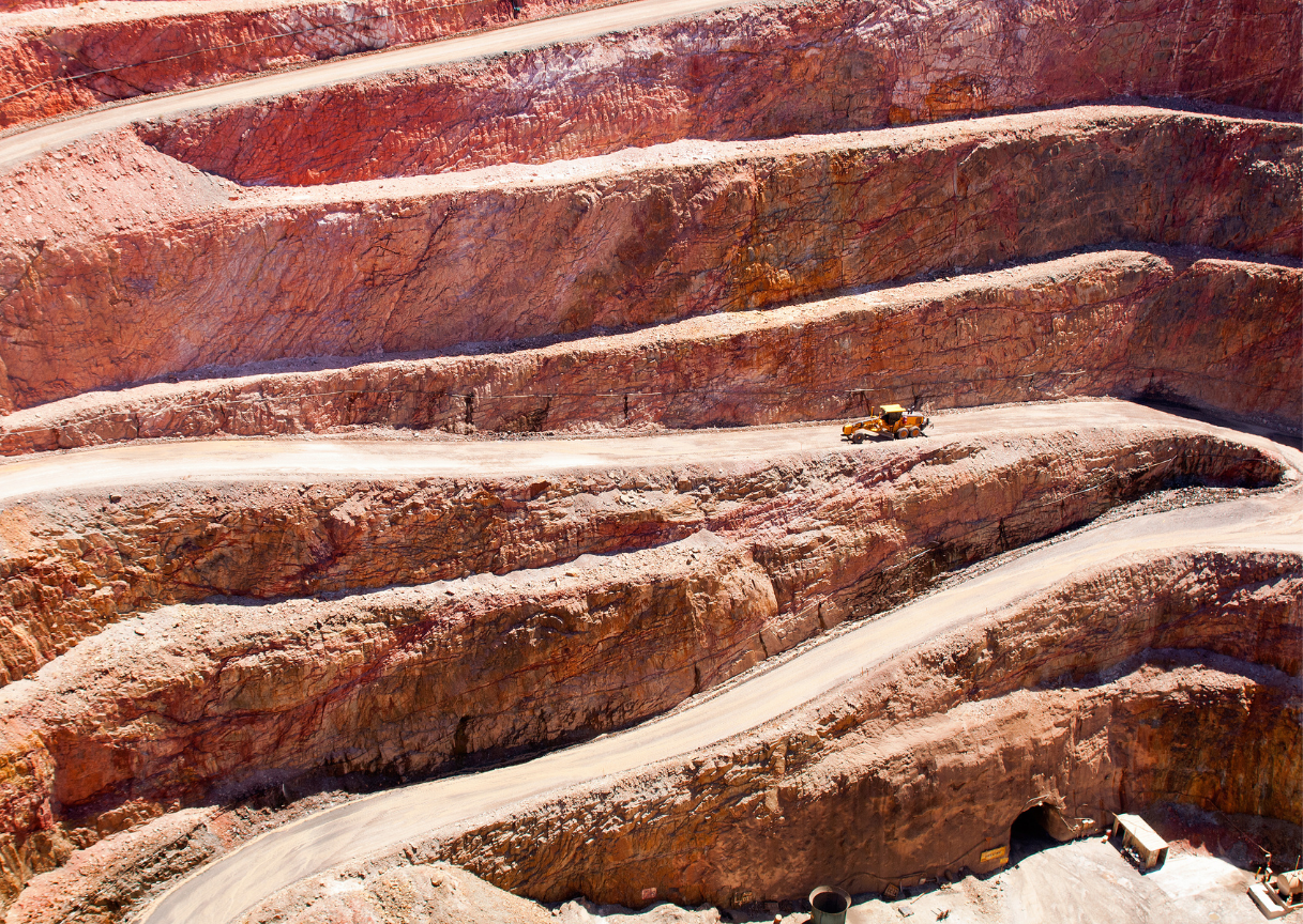
Haul roads are the circulatory system of a mine or quarry. Don’t let a clogged artery or slow bleed impair your site’s performance.
With modern mine intelligence platforms like Strayos, operations can extract these geometric and surface insights directly from the drone flights they are already running. Whether a site starts by auditing MSHA berm compliance or targeting high-rolling-resistance ramp sections, treating haul roads as measurable, engineered assets is one of the fastest ways to protect tires, cut diesel burn, and reclaim lost tons per hour.
Because in mining, it’s not just what you extract it’s how efficiently you move it.