Why You Should Be Using AI & Drone Data for Earthworks Projects
Why You Should Be Using AI & Drone Data for Earthworks Projects
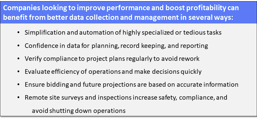
Excessive rework and poor project management due to bad data is the death knell of a successful earthworks project. Bad site data can have huge impacts on project costs and timelines leading to lost revenue, lost credibility, and lost business opportunities.
One way to avoid these pitfalls is to invest in better site data collection and management. This gives project planners and managers a better understanding of what they are actually working with and what is really needed, both in the beginning of a project and throughout its lifetime.
How does Drone Drone Data and AI Improve Earthworks Management?
Easy, you get: 1. Better Data, 2. Collected More Often, 3. Faster, and 4. Safer & More Compliant, than if you used traditional earthworks measurement and management methods.
1. Better Data
Traditionally measuring earth moved in a project was done in rough estimates like load counting. It's estimated that traditional survey methods have an accuracy rate of 80-95%. These rough estimates lead to poor site management decision making, under and over payments for contractors, rejected change orders, disagreements over bills, and sometimes significant re-work requirements when (and if!) errors are found.
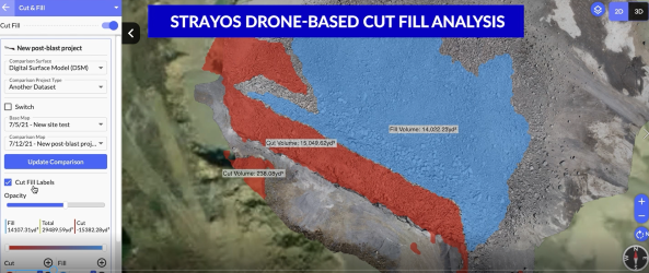
Now, Drone data and the 2D and 3D models created from their high resolution images is incredibly accurate, even better its unbiased. The accuracy of drones is undisputed anymore leading more and more companies to incorporate Aerial Intelligence into their operations playbook.
Its estimated that model measurement accuracy, like those created by Strayos, from drone imagery is about 99%.
Being able to share a running record of precise cut-fill amounts with team members and stake holders has changed the site management game. Now site managers can track actual earth moved and pay contractors based on reality. They can compare in granular detail site progress to design and catch any discrepancies early. And because of cloud hosting, the data can be shared amongst team members and stake holders to verify accounts, check details, and keep enthusiasm up.
2. Collected More Often
Drones have become so ubiquitous, affordable, and easy to fly, there is very little specialized training required. They can be controlled with automated flight plans via any number of apps on any smart phone or tablet which means just about any team member can fly the drone to collect the data- no more need to rely on specialized team members or third parties to collect the data. No more needing to work on their schedule.
Additionally, drones do not interfere with site operations. No more shutting down operations so surveyors can go out on the site to collect measurements.
Data can be collected much more often. Instead of conducting site surveys annually or even more rarely, now they can be conducted quarterly, monthly, or as needed to check on progress or site conditions.
3. Faster
Surveys that used to take hours or even days to be completed now take 15-30 minutes. Uploading the data and processing it into a 2D and 3D model takes almost no time. The AI analytics takes microseconds.
Depending on the size of the project, from arrival on site to report in hand now takes as little an hour(for a bench) to just a few hours (to map a pit). You could fly a drone in the morning and be ready for your team to get to work before lunch or every evening and have an accurate record of site conditions ready for you first thing the next morning.
Because of AI many or the tedious tasks of the past have been automated. What used to take time to annotate, log, or record is now completed instantly automatically. The AI compares the flight models of your choice so that you can see comparisons of the site data over time in seconds. Get measurements of every inch of your site to multiple decimal points. Reports, logs, and charts in any number of formats are generated in seconds making it easy to share critical information with all of the team, whether they are in the field, the site manager, or the accountant.
AI allows for CAD like analysis and performance with simple interfaces that anybody can use. so no need for specialized training to work with the software either. Get any team member up to speed on the interface quickly and easily.
4. Safer & More Compliant
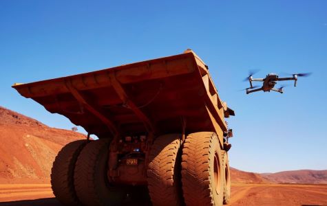
Because Drones can fly over a site to collect images, there is no more need to put team members on the site in harms way. No more unnecessary exposure to heavy machinery, or navigating treacherous site conditions. No more risks of onsite injuries. Heck, they wont even need the hard hart if they're far enough away. How amazing is it to know that not only are you making your site more efficient but you're also keeping your team safer in the process? How easy will it be to stay compliant then?
These 4 reasons added together equal one big value point:
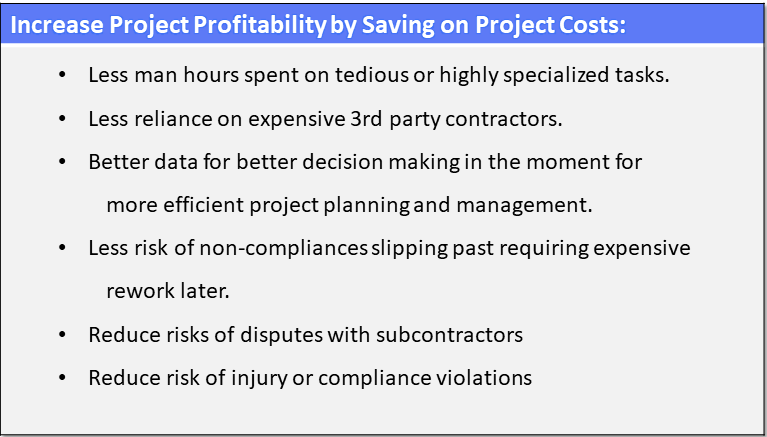
In today's insane market with its extreme volatility, any way a company can gain some security and make things a little more sure goes a long way to ensuring survival and even thriving. By incorporating AI and Drones companies can look to save up to 20% of total project costs or more.
Drone Data makes it cheap, fast, easy, and safe for sites to quantify, monitor, and manage earthwork operations. AI, whether its short for Aerial Intelligence, Augmented Intelligence, or Artificial Intelligence, is rocking the industry and giving way to insights that boost profitability in before unimaginable ways.
![]()
New technologies are rapidly changing the mining, extraction, and construction industries, empowering them in ways never before possible. Make sure you're taking advantage of the best tools available.
Check out our 2 Free E-books on AI applications for the drilling, blasting, and mining industries to see all the amazing advances that are available.
AI Guide for Drilling and Blasting
Want to watch our videos instead?